Property Details
Property Description
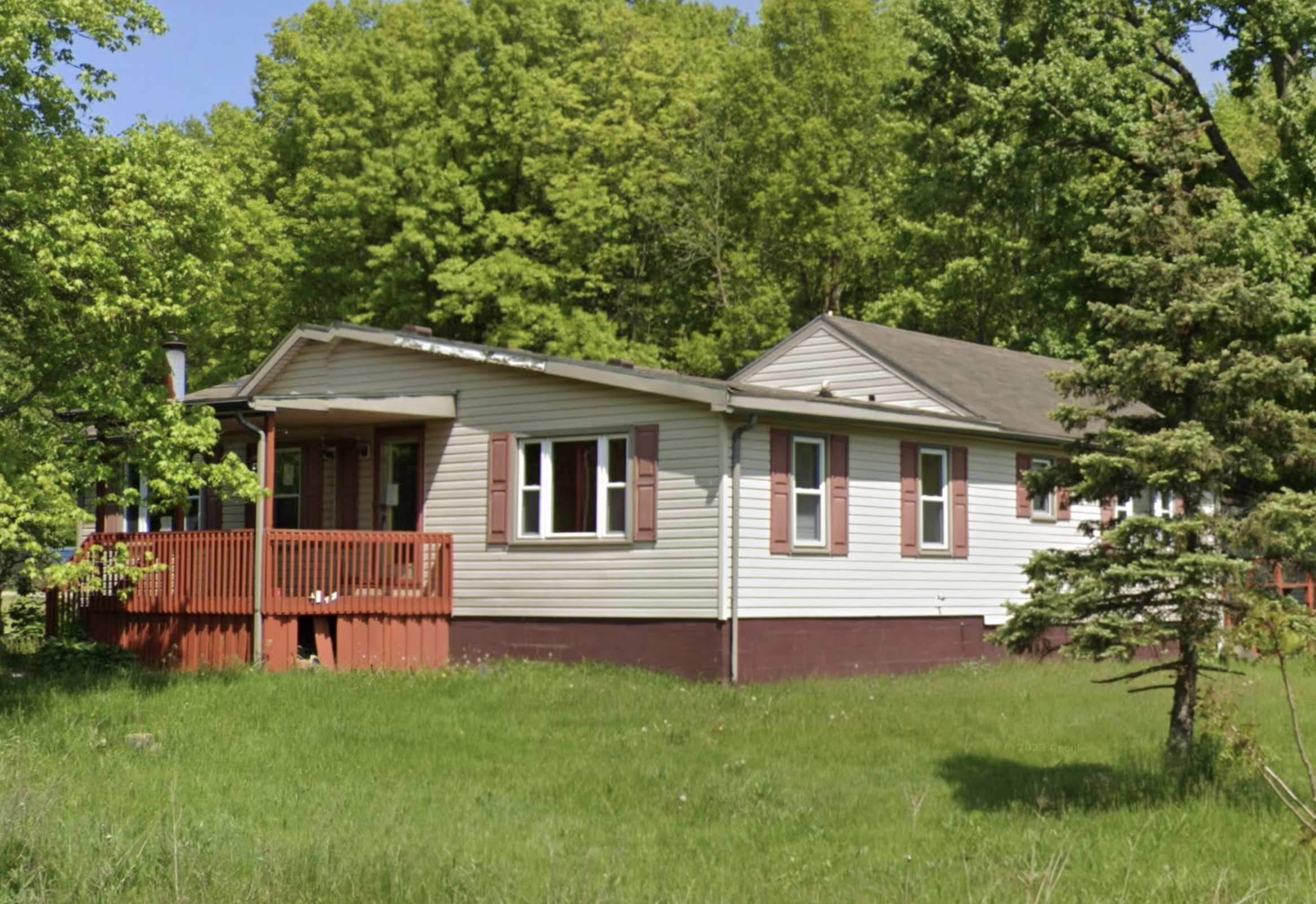
Subject property is a 2 BR / 1.00 BA w/ , containing 264 Sq Ft +/- built in 1925. Parcel number: 21-091340, 21-091350, 21-091351. Minimum Bid $ 50,000.00 . All auction end Wednesdays at 1PM. 5% buyer's premium will apply over and above high bid. Please read terms and conditions for details related to purchasing foreclosure property. Interior showings are not available. To earn a commission, Buyer referrals must be made to Auctioneer before prospective buyers make any contact with Auctioneer or register for bidding. Use link: https://www.gryphonusa.com/broker-acknowledgement-form/ This is a foreclosure situation. Property being offered by Private Selling Officer per the authorities granted in Ohio Revised Code 2329.152 . Information available has come from public sources and is believed to be accurate but is not guaranteed. Buyers should conduct their own due diligence before bidding. List Agent has not physically viewed the property. Due to the nature of the sale, interior inspections are not allowed. Cash sale only. The auction is subject to postponement and cancellation. No financing.
Legal Description
Situated in the Township of Weathersfield, County of Trumbull and State of Ohio: And known as being part of Section No. 24 in the 4000 Acre Tract of the Great Salt Springs Tract in the original survey of said Township and bounded and described as follows: Parcel One: Beginning at a point in the center line of the Carson Salt Springs Road, at the Southeasterly corner of a .18 acre parcel of land now or formerly owned by Thomas and Helen Myers; thence North 18 degrees East, along the Easterly line of said Thomas and Helen Myers, a distance of 161 feet to a point in the Northeasterly corner of said Myers .18 of an acre parcel of land; thence North 80 degrees 30' East, a distance of 20 feet to a point; thence South 18 degrees West, a distance of 161 feet, severing the lands of Antonia and Felix Magstrak, to a point in the center line of Carson Salt Springs Road; thence South 80 degrees 30' West, a distance of 20 feet to the place of beginning and containing 2,856 square feet of land, more or less, the same being approximately .06 of an acre. Parcel Two: Beginning at the Northwest corner of said lands formerly of Thomas and Helen Myers, which point is located North 18 degrees East, a distance of 161 feet from the center line of Carson Salt Springs Road; thence North 18 degrees East, a distance of about 28.32 feet to the Northerly boundary of lands now or formerly owned by John C. Myers; thence South 72 degrees East along the Northerly boundary of said lands of John C. Myers, a distance of about 44.4 feet to the Northeasterly corner of said lands of John C. Myers; thence South 18 degrees West, a distance of about 6 feet to the Northeasterly corner of said lands of Thomas and Helen Myers; thence South 80 1/2 degrees West along the Northerly boundary of said lands belonging to Thomas and Helen Myers, a distance of 50 feet to the place of beginning and containing approximately 770 square feet. Parcel Three: Beginning at a point in the center line of Carson Salt Springs Road at the Southeasterly corner of a .06 acre parcel conveyed to Russell D. Minick in Volume 925, Page 453, Trumbull County Records; thence North 18 degrees East, along the Easterly line of said .06 acre parcel, 161 feet to a point in the Northeasterly corner of said .06 acre parcel, 161 feet to a point in the Northeasterly corner of said .06 acre parcel and continuing North 18 degrees East, a distance of about 51.25 feet (for a total distance of about 212.25 feet) to a point which is in the intersection of the line heretofore described with the extension of the Northerly line of a .54 acre parcel conveyed to Tamara Ann McCall and Warren B. McCall in Volume 983, Page 999, extended South 77 degrees 29' West; thence North 77 degrees 29' East along said extension approximately 95.66 feet to an iron pin at the Northwesterly corner of a .54 acre parcel; thence South 3 degrees 30' West along the Westerly line of said .54 acre parcel 200 feet to a point in the center line of Carson Salt Springs Road, passing over an iron pin at 170 feet; thence South 80 degrees 30' West along said center line approximately 150 feet to a the place of beginning and containing .63 of an acre of land, be the same more or less, subject to all legal highways. Parcel Four: Commencing at the Southeast Corner of Lot No. 24 and extending West along the highway a distance of 50 feet; thence North 161 feet; thence East 50 feet; thence South to the place of beginning 161 feet and containing .18 of an acre. Be the same more or less, but subject to all legal highways.
Location
Foreclosure Details
Click the link to review the Conditions of Sale for this auction.
Conditions of SaleAuction By
