Property Details
Property Description
Subject property is a BR / 1.00 BA Single Family Home w/ No Garage, containing 996 Sq Ft +/- built in 1978. Parcel number: 170000022000, 170000047002. Minimum Bid $ 90,000.00 . All auction end Wednesdays at 1PM. 5% buyer's premium will apply over and above high bid. Please read terms and conditions for details related to purchasing foreclosure property. Interior showings are not available. To earn a commission, Buyer referrals must be made to Auctioneer before prospective buyers make any contact with Auctioneer or register for bidding. Use link: https://www.gryphonusa.com/broker-acknowledgement-form/ This is a foreclosure situation. Property being offered by Private Selling Officer per the authorities granted in Ohio Revised Code 2329.152 . Information available has come from public sources and is believed to be accurate but is not guaranteed. Buyers should conduct their own due diligence before bidding. List Agent has not physically viewed the property. Due to the nature of the sale, interior inspections are not allowed. Cash sale only. The auction is subject to postponement and cancellation. No financing.
Legal Description
Tract One: Situated in Knox Township, Guernsey County, Ohio, and being a part of the northeast quarter of Section #8, Township #3, Range #4, and being more particularly described as follows: Commencing at a stone found, the southeast corner of the southwest quarter of the northeast quarter of Section #8, thence on the east line of the southwest quarter of the northeast quarter of Section #8, N 01 deg. 30' E a distance of 806.63 feet to an iron pin found, thence S 88 deg. 11'43" W, a distance of 532.00 feet to an iron pin found, thence N 01 deg. 30' E a distance of 681.65 feet to a point in the center of SR #658, (having passed through an iron pin found at 836.65 feet), thence with the center of SR #658, S 48 deg. 16'39" W, a distance of 32.37 feet to a point, the beginning, thence with the center of SR #658, the next five (5) calls: (1) S 48 deg. 16'39" W, a distance of 134.41 feet to a point; (2) S 51 deg. 20'43" W, a distance of 20.11 feet to a point; (3) S 76 deg. 05'46" W, a distance of 138.81 feet to a point; (4) N 82 deg. 13'39" W, a distance of 267.31 feet to a point; (5) N 83 deg. 57'42" W, a distance of 21.68 feet to a point, thence with the center of an old road bed the next four (4) calls: (1) N 69 deg. 16'45" E, a distance of 104.17 feet to an iron pin set, (having passed through an iron pin set at 50.60 feet); (2) N 53 deg. 42'50" E, a distance of 870.75 feet to an iron pin set; (3) N 68 deg. 27'11" E, a distance of 114.03 feet to an iron pin set; (4) N 63 deg. 59'07" E, a distance of 278.38 feet to an iron pin set, thence S 06 deg. 55'34" E, a distance of 152.80 feet to the beginning, (having passed through an iron pin set at 110.99 feet), and containing 1.610 acres more or less, and being all of the property conveyed to Ronnie Colvin in volume 304, page 489 of the deed records of Guernsey County, Ohio, as 1.00 acres more or less. For further reference of this property, see Volume 189, Page 16 and Volume 121, Page 496 of the deed records. Subject to all easements or leases of public record. Iron pins set are 5/8 inch rebar. A survey of the above described property was made by Joseph T. Spilker, Registered Surveyor #S-5862 on May 8, 1978. Tract Two: Situated in the Township of Knox, in the County of Guernsey and State of Ohio, and being 7.545 acres more or less in the Northeast Quarter of Section #8, Township #3 North, Range #4 West of the United States Military Lands Survey and being more particularly described as follows: Commencing at an iron pin found at the Northeast Corner of the Northwest Quarter of the Northeast Quarter of Section #8, thence with the east line of the Northwest Quarter of the Northeast Quarter of Section #8 S 01 deg. 06'54" W a distance of 587.57 feet to an iron pin set the Beginning, thence with the east line of the Northwest Quarter of the Northeast Quarter of Section #8, S 01 degree 06'54" W a distance of 432.40 feet to a P.K. nail set in the center of S.R. #658, Thence with the center of S.R. #658 and the lands of now or formerly William Seal as found in Official Record Book #9, Page #8 of the Official Records of Guernsey County, Ohio, and the lands of now or formerly Kenneth McGhee as found in Volume 383, page 819 and Kenneth Sarratt as found in Volume 362, page 303 of the deed records of Guernsey County, Ohio, the following three (3) calls: (1) S 78 degrees 34'48" W a distance of 199.89 feet to a P.K. nail set. (2) Thence with a curve to the left with the following properties: Delta 30 degrees 40'51" radius 636.62 feet, chord bearing S 63 degrees 14'20" W, Chord distance 336.84 feet to a P.K. Nail Set. (3) S 47 degrees 53'53" W a distance of 84.86 feet to a P.K. Nail Set, Thence with the lands of now or formerly Ronald and Wanda Colvin as found in survivorship Deed Volume 340, Page 357 of the deed records of Guernsey County, Ohio N 07 degrees 18'20" W a distance of 152.80 feet to an iron pin set, thence with the land of now or formerly Ruth Baker as found in Volume 375, page 272 of the deed records of Guernsey County, Ohio N 00 degree 09'28" W a distance of 613.96 feet to a point in a run, thence with a new division line through the lands of now or formerly Mark Oliver Etal, as found in Official Record Book 14 page 1067 of the Official Records of Guernsey County, Ohio, the following Three (3) calls: (1) S 88 degrees 32'19" E a distance of 300.75 feet to an iron pin set (having passed through an iron pin set at 15.00 feet); (2) S 01 degree 06'54" W a distance of 70.00 feet to an iron pin set. (3) S 88 degrees 32'19" E a distance of 290.00 feet to the beginning and containing 7.545 acres more or less and being a part of the property conveyed to Mark Oliver Etal as found in Official Record Book 14 Page 1067 of the Official Records of Guernsey County, Ohio. Subject to all easements or leases of public record. Iron pins set are 5/8 inch rebar 30 inches long, capped Spilker LS-5862. Bearings are Magnetic and are for angle purposes only. A survey of the above described property was made by Joseph T. Spilker, Registered Surveyor #S-5862. Excepting therefrom the following described premises: Situated in Knox Township, Guernsey County, Ohio, and being 1.254 acres more or less in the Northwest Quarter of the Northeast Quarter of Section #8, Township #3 North, Range #4 West in the United States Military Lands Survey and being more particularly described as follows: Commencing at an iron pin found at the northeast corner of the Northwest Quarter of the Northeast Quarter of Section #8, thence with the East line of the Northwest Quarter of the Northeast Quarter of Section #8, S 01 deg. 06'54" W a distance of 587.57 feet to a point the beginning, thence with East line of the Northwest Quarter of the Northeast Quarter of Section #8 and the lands of now or formerly Grace Mourer as found in Official Record Book 97 Page 348 S 01 deg. 06'54" W a distance of 432.40 feet to a P.K. Mail found in the center of T. R. #811 and S.R. #285, thence with the center of S.R. #285 and the lands of now or formerly William P. Seal as found in Official Record Book 97, Page 134 S 78 deg. 34' 48" W a distance of 135.61 feet to a point, thence with the lands of now or formerly Ruth D. Baker as found in Volume 375 page 272 N 03 deg. 34' 40" E a distance of 462.94 feet to an iron pin set (having passed through an iron pin set at 20.14 feet), thence with the lands of now or formerly Mark E. Oliver as found in Official Record Book 49, Page 340 S 88 deg. 32' 19" E a distance of 112.49 feet to the beginning and containing 1.254 acres more or less and being a part of the property conveyed to Ronald E. Colvin in Official Record Book 49, Page 342. Subject to all easements or leases of public record. Iron pins set are 5/8 inch rebar 30 inches long capped Spilker LS-5862. Bearings are magnetic and are for angle purposes only. A survey of the above described property was made by Joseph T. Spilker, Registered Surveyor #S-5862 on February 21, 2000.
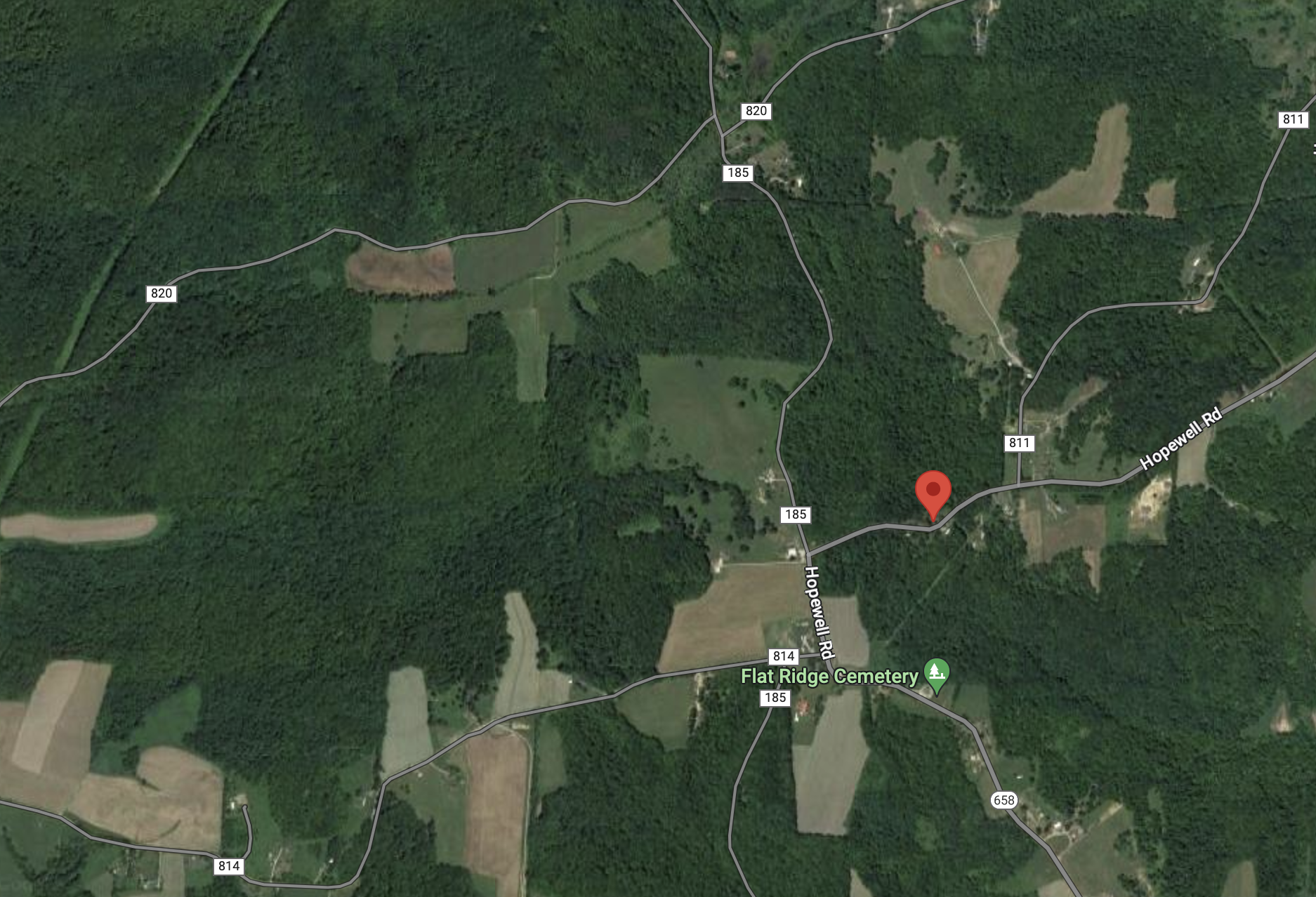
Location
Foreclosure Details
Click the link to review the Conditions of Sale for this auction.
Conditions of SaleAuction By
